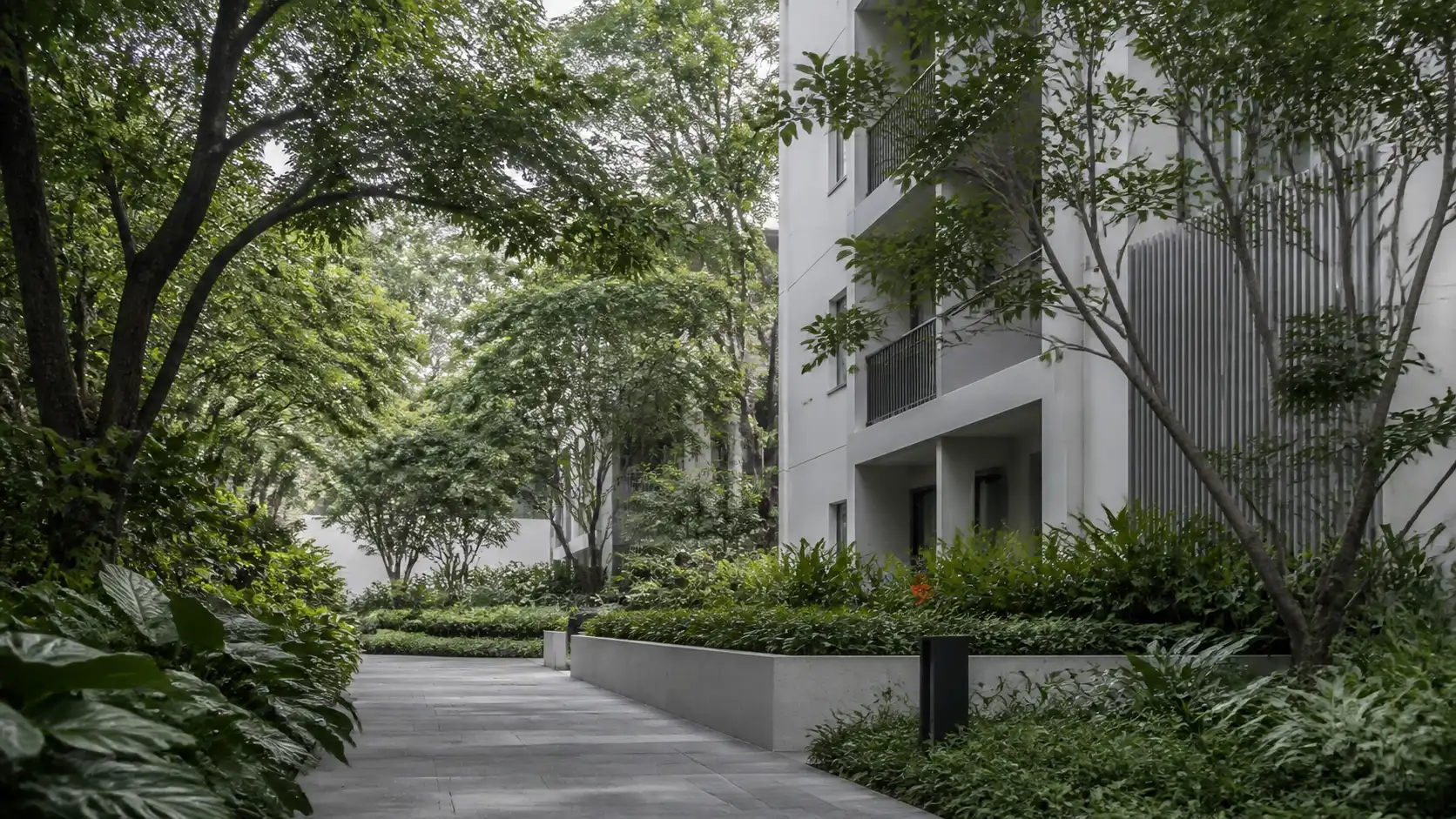
Dommasandra · off Sarjapur Road · Bengaluru
Total Environment Butterfly of Dreams Apartments, Dommasandra off Sarjapur Road
Explore Total Environment Butterfly of Dreams in Dommasandra off Sarjapur Road: 1,188 homes in six towers on 22.25 acres. View the master plan and amenities.
| Project detail | Current information |
|---|---|
| Location | Dommasandra, off Sarjapur Road |
| Gross site | Approximately 22.25 acres |
| Residential programme | 1,188 proposed residential units |
| Built form | Six proposed residential towers and one commercial block |
Request project details
Butterfly of Dreams in Dommasandra
Butterfly of Dreams is planned as a large mixed-use development in Dommasandra off Sarjapur Road, an area that sits between the Sarjapur employment corridor and the road network leading toward Bellandur, Whitefield and Electronic City. The site schedule covers approximately 22.25 acres gross and 21.73 acres net. Within that land, the residential programme accounts for 1,188 apartments in six towers, while a separate commercial block occupies the north-east parcel. The combination creates a campus-scale project with several daily movement patterns: residents reaching their towers, visitors arriving at the commercial parcel, service traffic using internal drives and pedestrians moving through the landscape. The location therefore matters at two levels. It connects the development with schools, workplaces, healthcare and rail references around Sarjapur Road, and it also shapes the arrangement of entries, internal roads and buildings within the site itself.
The landscape allocation gives Butterfly of Dreams a second defining theme. Approximately 8.73 acres is identified as landscape, equal to about 40% of the net site area, and the schedule includes 800 trees. This green structure sits alongside 8-metre fire driveways, a 12-metre driveway, a re-routed nala, a 15-metre nala setback, a foot track and the civic-amenities parcel. These are not isolated statistics: together they decide how much of the ground plane can function as planted open space, how the towers relate to one another and how people move between home, shared facilities and the site entrances. The residential towers form a long southern row, giving each position a different relationship with the main road, commercial parcel, landscape bands and neighbouring towers. The master-plan section brings those relationships together in one plan view so the project can be read as a complete site rather than a list of headline numbers.
The homepage follows the same decision order. The overview establishes land area, residential scale, tower heights and the project company. The master plan explains the tower row, commercial parcel, access sequence, driveways and landscape. The amenities section covers the clubhouse, planting, circulation, sewage treatment, rainwater recharge, organic-waste processing and solar systems through dedicated 3D studies. The location section groups schools, employment hubs, rail, healthcare, roads and the airport into concise distance tables. The floor-plan section states the present drawing availability and explains the measurements that matter when a project plan is published. The price section focuses on the structure of a complete unit-specific quotation. Gallery and questions complete the picture with large visual scenes and direct project answers. This structure keeps each topic distinct while giving buyers one continuous account of Total Environment Butterfly of Dreams apartments in Dommasandra and the wider Sarjapur Road setting.
Total Environment Butterfly of Dreams overview
Total Environment Butterfly of Dreams brings a large residential programme to Dommasandra off Sarjapur Road. The planning schedule covers approximately 22.25 acres gross and 21.73 acres net, with 1,188 apartments arranged across six residential towers and a separate commercial block. Towers 1 to 5 rise above three basements and a ground level to 36 upper floors, while Tower 6 reaches 37 upper floors. Around 8.73 acres is allocated to landscape, equal to about 40% of the net site area, and the schedule includes 800 trees. This combination of campus scale, landscape allocation and access to the Sarjapur Road employment corridor defines the project overview before individual decisions about plans, amenities, location and price.
- Project name
- Total Environment Butterfly of Dreams
- Builder name
- Total Environment Building Systems Private Limited
- Location
- Sarjapur / Dommasandra / Thigalachowdenahalli, Bengaluru
- Project address
- Survey Nos. 78/2, 78/3, 79/6 and 79/8, Thigalachowdenahalli; Survey Nos. 198/2, 198/3, 198/4, 198/6, 199/1, 199/2, 200/1, 200/2, 201/1, 201/2, 201/5, 202/1, 202/4, 202/5, 203/2–203/6 and 205, Dommasandra; Sarjapura Hobli, Anekal Taluk, Bengaluru Urban, Karnataka
- Project type
- Proposed mixed-use development — residential and commercial
- Total land area
- Approximately 22.25 acres gross and 21.73 acres net
- Residential programme
- 1,188 proposed residential units
- Towers / blocks
- Six proposed residential towers and one commercial block
- Floor levels
- Towers 1–5: three basements + ground + 36 upper floors; Tower 6: three basements + ground + 37 upper floors; commercial block: four basements + ground + 34 upper floors
- Apartment floor plans
- Not published for public display
- Proposed amenities and infrastructure
- Landscape and civic-amenity areas, clubhouse reference, surface parking, internal drives and fire movement, sewage treatment, transformer and DG infrastructure, rainwater systems, organic-waste processing, solar systems and 800 proposed trees
- Project highlights / offer
- Approximately 22.25 acres, 1,188 proposed homes, six residential towers, about 40% proposed landscape and 800 proposed trees. No current project-specific offer is established
Total Environment Butterfly of Dreams master plan
The Butterfly of Dreams master plan is organised as a mixed-use campus rather than a collection of isolated towers. Six residential towers form a long row across the southern portion of the site, while the commercial block occupies a separate parcel toward the north-east. Sarjapura–Ambalipura Main Road defines the northern edge, creating the principal relationship between the development and the surrounding Dommasandra road network. Four access points are marked along the commercial parcel frontage in an Exit, Entry, Exit and Entry sequence. Internal circulation includes 8-metre fire driveways and a 12-metre driveway, with residential movement, commercial movement and emergency access forming separate layers in the plan. The landscape structure runs between and around the buildings and forms part of the stated 8.73-acre allocation. A re-routed nala, 15-metre nala setback, foot track, civic-amenities parcel and road-widening area also shape the usable site. Together, these elements explain why tower position matters. A home near the northern side will relate differently to the main road and commercial parcel than one deeper in the residential row. The master-plan image makes the site sequence legible by showing tower order, access points, landscape bands and circulation in one view.
Total Environment Butterfly of Dreams master plan
Total Environment Butterfly of Dreams floor plans
Apartment floor plans have not been published for Total Environment Butterfly of Dreams, so the homepage does not present generic 3 BHK or 4 BHK studies as project layouts. The useful information at this stage is the framework for reading a project drawing when one is released. Area should be stated with a clear basis because carpet, built-up and saleable figures describe different parts of the same home. Room dimensions then show whether beds, wardrobes, dining furniture and storage fit without blocking movement. Window positions, balcony depth, kitchen-to-utility access and bathroom entry determine how the plan works after furniture is added. Tower and stack references connect the apartment drawing to the wider master plan, including lift access, orientation, neighbouring buildings and outlook. A complete floor-plan set also identifies the unit reference and revision, allowing the drawing to be matched with its specification and commercial schedule. The dedicated floor-plan page keeps this availability position clear and will provide a natural home for measured project drawings when suitable material is published.
Total Environment Butterfly of Dreams amenities and open space
The Butterfly of Dreams amenities programme is led by landscape and site infrastructure. Approximately 8.73 acres is allocated to landscape, representing about 40% of the net site area, and the planning schedule includes 800 trees. That scale creates room for planted circulation and shared outdoor space across a campus of six residential towers. A clubhouse is included in the recorded programme, alongside internal drives, ramps, service areas and parking. The supporting systems are equally prominent: a 2,020 KLD sewage treatment plant, a 1,020-cubic-metre rainwater sump, 22 recharge pits, an organic waste converter, solar water heating and solar lighting. These categories describe how water, waste, energy and daily movement are intended to work together across the development. The amenity cards make each part easy to distinguish. Landscape and tree planting form the green layer; the clubhouse represents shared community space; circulation and parking explain movement; sewage treatment, rainwater recharge, organic-waste processing and solar systems cover the service infrastructure behind everyday operation. This combination gives the amenities section a broader purpose than a lifestyle list by showing the environmental and operational systems that support a large residential campus.

Landscape and 800-tree programme
Tree planting, connected gardens and shaded routes shape the main outdoor amenity layer.

Clubhouse reference
Shared lounges and adjoining outdoor areas support resident gatherings, community activities and informal meetings.
Circulation and parking
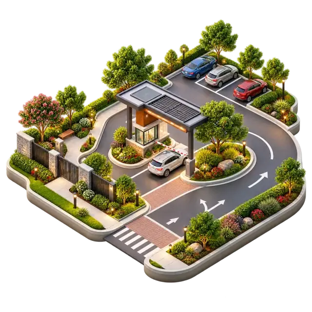
Internal driveways, pedestrian edges and parking zones clarify how vehicles and residents move through the site.

Sewage treatment
Treatment tanks, aeration equipment and reuse pipework support wastewater processing within the site systems.

Rainwater and recharge
Collection tanks, recharge pits and reuse pipework help retain rainfall and support groundwater replenishment.

Organic waste processing
Segregated bins and an on-site processing unit support organised handling of biodegradable household waste.

Solar water and lighting systems
Roof-mounted hot-water equipment and shared-area lighting support lower-energy day-to-day operation.
Total Environment Butterfly of Dreams price
Total Environment Butterfly of Dreams pricing is best read through a unit-specific cost sheet rather than a single corridor rate. The commercial picture begins with the selected tower, stack, floor and home reference, followed by the area and the basis used for that area. The base consideration is only one part of the total. Floor or location preferences, parking, infrastructure or club charges, deposits, maintenance, corpus, documentation, taxes, stamp duty and registration can all change the amount payable. A dated quotation also shows how long the terms remain valid and whether every amount belongs to the same project and phase. Payment timing matters because a schedule may be linked to dates, construction milestones or document events. Keeping those triggers beside the corresponding amounts makes two quotations easier to compare. The absence of a published public price list does not require the page to display empty 3 BHK and 4 BHK cards. Instead, the price guide focuses on the structure of the cost sheet and the information needed to compare one identified apartment with another on the same basis.
Total Environment Butterfly of Dreams gallery
The Butterfly of Dreams gallery uses six large-format scenes to create a visual journey through arrival, landscape and residential interiors. The arrival court introduces the transition from the public road to the residential setting. A tree-canopy walk develops the landscape theme through shade, planting and pedestrian movement. The living and dining image shifts the sequence indoors and shows how shared family spaces can connect with greenery, while the bedroom focuses on privacy, light and outlook. A planted balcony links the apartment back to the landscape, and the courtyard threshold closes the set with a quieter shared-space moment. Concise labels keep the emphasis on the images rather than surrounding every photograph with repeated context wording. The masonry presentation gives the first image greater visual weight and allows the remaining scenes to form a varied gallery rather than a row of identical content cards. Together, the images provide an easy way to discuss preferences for arrival character, tree cover, interior proportions, balcony use and the relationship between built space and planting.
Arrival court context
Tree-canopy walk context
Living and dining context
Bedroom context
Planted balcony context
Courtyard threshold context
Total Environment Butterfly of Dreams location
Butterfly of Dreams is in the Dommasandra area off Sarjapur Road, with the project schedule also covering land in Thigala Chowdenahalli. This position connects the site with several parts of Bengaluru’s south-east employment and education network. Dommasandra Circle is the nearest listed road reference. Oakridge International School, Greenwood High International School and The International School Bangalore form the local school cluster. Wipro Kodathi SEZ and RGA Tech Park represent the Sarjapur Road employment corridor, while Electronic City and International Tech Park Bangalore extend the workplace comparison toward the south and east. Carmelaram railway station provides a rail reference, Spandana Hospital a healthcare reference, and Outer Ring Road at Bellandur the link toward the larger office corridor. Kempegowda International Airport is the long regional journey in the table. The homepage keeps this information readable through destination-and-distance rows only; it does not repeat locality and route descriptions inside every card. The dedicated location guide combines the concise distance table with a map and a fuller account of the Dommasandra, Sarjapur Road, Bellandur and Whitefield relationships.
Dommasandra, Karnataka, IN
Road
| Destination | Distance |
|---|---|
| Dommasandra Circle | 0.4 km |
| Outer Ring Road at Bellandur | 9.0 km |
School
| Destination | Distance |
|---|---|
| Oakridge International School | 1.3 km |
| Greenwood High International School | 2.0 km |
| The International School Bangalore | 3.3 km |
Employment
| Destination | Distance |
|---|---|
| Wipro Kodathi SEZ | 4.3 km |
| RGA Tech Park | 5.9 km |
| Electronic City Phase 1 | 10.3 km |
| ITPL Whitefield | 11.5 km |
Railway station
| Destination | Distance |
|---|---|
| Carmelaram Railway Station | 5.3 km |
Hospital
| Destination | Distance |
|---|---|
| Spandana Hospital | 5.3 km |
Airport
| Destination | Distance |
|---|---|
| Kempegowda International Airport | 35.4 km |
Total Environment Butterfly of Dreams questions
The Butterfly of Dreams questions section brings the project’s main facts into a quick decision format. The site covers approximately 22.25 acres gross and 21.73 acres net, with 1,188 residential units planned across six towers and a separate commercial block. Towers 1 to 5 are described with three basements, ground and 36 upper floors, while Tower 6 reaches 37 upper floors. The landscape allocation is approximately 8.73 acres, stated as 40% of net site area, with 800 trees in the schedule. The systems programme includes sewage treatment, rainwater storage and recharge, organic-waste processing, solar water heating and solar lighting. Location answers connect Dommasandra and Sarjapur Road with schools, employment hubs, rail, healthcare and the wider Bengaluru road network. Floor-plan answers state the present public availability clearly, while price answers explain the cost-sheet fields that matter when a quotation is issued. Master-plan answers cover tower arrangement, the commercial parcel, access points, driveways and landscape structure. This makes the FAQ a compact reference for scale, built form, open space, systems, location, plans and commercial information without repeating the full route articles.
Is this actually a Total Environment project, or just named after one?
Total Environment Building Systems Private Limited is named as the builder in the current project information, and the project-specific landscape plan states A Total Environment Project. Before paying or signing, compare the promoter, seller, payment recipient and authorised signatory across the current registration, allotment and agreement documents. The About page lists the named parties and the buyer checks to complete before an enquiry.
Whose name will be on my agreement?
The company named in the current planning information is iinspira gold county llp, described here as the project company and nothing more. A company that appears on a planning submission is not automatically the developer, the promoter, the seller or an authorised sales channel. Those are four distinct roles and they are often held by different entities. So the practical answer is that nobody can tell you today which name your agreement will carry. When a registration record exists, read the promoter name on it and check that it matches your allotment letter, your agreement and the account you are asked to pay into.
How big is the project, and how many flats are there?
Gross site area is 90,059.57 sq m, roughly 22.25 acres. Net site area is 87,935.00 sq m, roughly 21.73 acres. The residential programme proposes 1,188 units in six residential towers, with one commercial block alongside. The gross-versus-net distinction matters when you shop around. Open-space percentages and density are calculated on net area, so if a competing project quotes open space against gross you are not comparing like with like. Ask which basis any figure uses before you put two projects side by side.
How tall are the towers, and does that affect daily life?
Towers 1 to 5 are proposed with three basements, ground and 36 upper floors. Tower 6 goes one level higher at 37 upper floors. The commercial block sits on four basements with ground and 34 upper floors. It affects daily life more than most buyers expect. Spread 1,188 homes across six towers and you get roughly 200 households per tower moving up and down 36 or 37 floors. Lift count per tower, whether a separate service lift exists, and the design waiting time at 8:30 on a weekday are the questions worth asking. None of them can be retrofitted once the cores are cast.
Where exactly is it, and how do I judge the commute?
The planning point is in Dommasandra, off Sarjapur Road, Bengaluru, at approximately 12.882958, 77.746561. Judge the commute by driving it rather than by reading kilometres. Dommasandra sits where Sarjapur Road meets the road toward Whitefield and Varthur, which is the locality's main argument: it puts a household between two employment geographies instead of inside one. Drive your own route on a weekday morning and again on a weekday evening. Any distance quoted without a route and a time of day attached tells you very little here.
Are apartment floor plans available?
Apartment floor plans have not been published for public display. When a drawing becomes available, read it with the configuration schedule and area statement. Confirm the area basis, room dimensions, balcony depth, utility placement, storage walls, orientation, tower and stack before matching it to a cost sheet.
What is the price per sq ft?
A current project-specific rate or cost sheet is not published here. When a quotation is available, the useful comparison is the total amount payable for one identified apartment on a stated area basis and within a stated validity period. Keep the quotation beside the matching floor plan and area statement so the commercial figure can be traced to the same home.
What should a proper cost sheet contain?
A usable cost sheet is dated and unit-specific. It names the legal project, the phase, the tower, the stack, the floor, the configuration, the area with its basis stated, and a validity period. Anything missing those fields is an indication. Under the base consideration sit the charges that decide the real number: floor rise, preferential location charges, car parking, clubhouse charges, infrastructure charges, power backup per kVA, maintenance deposit and advance maintenance, corpus, documentation, then GST, stamp duty and registration. Carpet, built-up and super built-up are three different numbers for the same home, so ask for carpet area in writing and for the loading percentage against super built-up.
Is it launched? Is it registered? When is possession?
None of those are established. No confirmed public launch date, registration identifier, possession date, construction status or inventory status exists for this project on the current evidence. That is a normal position for a scheme at this stage and it is not a reason to walk away. It is a reason to know which stage you are at. Without a registration identifier there is nothing to verify, which in turn means no legally advertisable price and no bookable inventory. If somebody offers you a pre-launch booking today, the single question to put to them is which registration identifier the booking is being made under, in writing.
How much open space is there, and is 40% real?
The proposal allocates 35,313.68 sq m of landscape, stated as 40% of net site area, with 800 proposed trees. Against a net site area of about 21.73 acres that is roughly 8.73 acres, and it is a strong allocation for a high-rise scheme in this corridor. Whether it is real depends on a question the percentage cannot answer. Open space legitimately includes setbacks, planted strips along internal drives, swales and the greenery around a basement ramp. So ask how much of it is contiguous, at ground level, and walkable from your tower without crossing a vehicle route. On the 800 trees, ask how many are retained mature trees and how many are new saplings.
What water, waste and energy systems are planned?
A 2,020 KLD sewage treatment plant, a 1,020 cubic metre rainwater sump and 22 recharge pits are proposed. An organic waste converter, solar water heating and solar lighting are in the same programme. All of it is proposed infrastructure, with no operating performance or delivery date established. For 1,188 homes, 2,020 KLD works out near 1,700 litres of treatment capacity per home per day, which is a real provision rather than a token one. On a corridor where water security is the recurring worry, that matters. Two follow-ups are worth asking: whether treated water is plumbed back for flushing and irrigation, and who operates the plant after handover.
Is there a clubhouse, a pool and a gym?
A clubhouse appears in the planning programme, alongside a civic-amenity allocation, internal drives and ramps, service areas and parking infrastructure. What does not exist is an itemised clubhouse schedule: no published room-by-room list, no confirmed pool, no gym specification, no sports provision, no access rules and no delivery phase. This is where the variability lives, because two projects can both say clubhouse and mean a large facility or a room with three treadmills. Ask for the clubhouse area in square feet, ask which phase it is delivered in relative to your tower, and ask whether commercial-block visitors have access to any residential amenity.
Can I see the master plan, and what does it show?
Yes. A labelled site-plan study of the current project site plan is on the master plan page. It is an interpretation rather than a sanctioned drawing or a scale measurement, so do not take a dimension off it. It shows Towers 1 to 6 in a long southern residential row with the commercial tower on a separate north-east parcel, Sarjapura–Ambalipura Main Road along the north edge, 8 m fire driveways, a 12 m driveway, a re-routed nala with a 15 m setback and foot track, a civic-amenities parcel, landscape bands and 704.15 sq m marked for road widening.
Where are the entry and exit gates?
The site plan marks four road-facing access points along the north frontage, sequenced Exit, Entry, Exit and Entry reading left to right on the drawing. That sequence reproduces what Four access points on one frontage is usually a sign that residential and commercial movement were meant to be separated, which is the right instinct on a mixed-use site. Confirm it on the ground when the current plan is issued: which gate residents use, where commercial visitors go, and whether delivery and service vehicles share a gate with you.
Can I download the floor plan or a brochure PDF?
Apartment floor plans are not available for public display on this site. The master-plan page presents the project site layout. Use the contact form to ask for the current configuration schedule, measured floor plan, area statement, specification and cost sheet, then check that the project name, phase and revision match across the set.
There is a commercial tower on the site. Is that a problem?
It cuts both ways, and the plan gives you enough to judge it. One commercial block is proposed, on four basements against the residential towers' three, and it occupies its own north-east parcel rather than sitting among the homes. Both details suggest the separation was designed rather than improvised. A well-separated mixed-use plan means you walk to a pharmacy. A poorly separated one means service vehicles share your entrance and visitor parking spills into residential bays. The checks are ground-level ones: where commercial visitors enter, where their vehicles go, how retail frontage is oriented, and how servicing is routed at the weekend.
Continue your project shortlist
Use the overview to connect the key facts before comparing individual decisions.